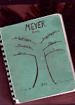
Anlegung eines Kirchhofes für die Gemeinden Göhrde und Röthen im Kirchspiel Nahrendorf, enthält Handzeichnung mitdem neuen.
Monday, March 30, 2009
Helpful link -izn-AIDA online Gemeinden Göhrde und Röthen
Anlegung eines Kirchhofes für die Gemeinden Göhrde und Röthen im Kirchspiel Nahrendorf, enthält Handzeichnung mitdem neuen.
Friday, March 27, 2009
Blogger from 'Applestone Cottage '-- Shares Her Trip to Galena Illinois
 ~~~ Her Trolley pic. I have a thing about Trolleys.~~~
Note: The sign said 1860 on one of her pictures. The war was over a few years before Fred came to America. After 1865 or so. Hmm, I wonder if Mr. Ahrens or Mollemann were in the war.
Note: There has been mention of a connection with a Grant family, somehow??? Anyone in the know?
Thursday, March 26, 2009
Check out the link of the Galena Public Library District
You never know when you might want to try another source. You can click the link.
Galena Public Library District: "Resources
1. FEDERAL, STATE AND TERRITORIAL CENSUSES ON
MICROFILM:
Jo Daviess County, Illinois: Federal: 1830, 1840, 1850, 1860, 1870, 1880, 1900, 1910, 1920 (all indexed)
State: 1855, 1865 (indexed)
Carroll County"
Thursday, March 12, 2009
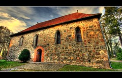
Heimatmuseum Dahlenburg II
Originally uploaded by PhotoArt Hartmann
http://www.flickr.com/photos/9184647@N02/3224449277/ Has this fantastic artist, photographer. I hope you will go admire his work. He has a third one Dahlenburg 111 worth a look.
Gorgeous
For more information look here also.
Tuesday, March 10, 2009
Seil familien namen - family name


August W. Seil
1---Annie Seil, granddaughter of August William SEIL from Dahlenburg and Uelzen. [ She was also a Child of Lizzie Seil Jaeschke]
It's time to discuss further the SEIL family from Dahlenburg and Oldendorf, bei Nahrendorf.
Besides the SEIL from Dahlenburg, many other Seil names and locations have appeared in documents. Already at one point or another I have mentioned the familien namen Seil from other locations:
11--Heinrich Seil geb. ab. 1859 bei Oldendorf.
[ oo - Mary Ahrens from Bleckede] Below here is a son Carl Seil on our left. Carl Seil and Dwight were fishing friends. Carl came up from Iowa to fish at the southern Minnesota lakes with Dwight.
 Evidently a card received at Sunnyslope Farm in Watowan county one christmas from Carl Seil's family.
111- Juergen Friedrich Seil a farmhand from Lueben oo 30.04.1822 Catharina Maria Luhmann marriage at Eichdorf / Nahrendorf. [Hers -*1794- +1848]
lV-- The Juergen Christoph Heinrich Seil of Breese oo 16.11.1810 Margaretha Magdalena Luhmann marriage at Eichdorf / Nahrendorf [ Hers - *1791 -]
V--- Marg. Dor. [neeSeil] Meyer. Her name came to me from the church. Here is a portion of my past post where she is mentioned. " This was the most important question to ask. It was the god parent of our Juergen Heinrich Friedrich Meyer geb.1851. Who was he. The brief explanation did not help much to supply meaning to any reading between the lines.Juergen Friedrich Meyer, schulze of Oldendorf oo- md 18. april.1834 with Margaretha Dorothea (Bausch) Schroeder widow of Juergen Heinrich Schroeder of Oldendorf. Juergen Friedrich Meyer's parents were Hauswirth Johann Heinrich Meyer of Sueschendorf and his wife Marg. Dor. Seil."
Not much more here
1---- Annie Seil [00 marriage in Iowa/ Minnesota - 1909] with Herman Meyer >

1---Lizzie Seil [Dahlenburg and Uelzen > Hildesheim connection of her mothers forefathers familiennamen KORN] > her father - August Friedrich Wilhelm Seil of Dahlenburg
More will follow shortly. I would like to spend more time on August Friedrich Wilhelm Seil of Dahlenburg. Family names of Brookmann, Schmidt, [Korn, Culemann, Lietz, Hofmann from Himbergen Uelzen].
Tuesday, March 3, 2009
Göhrde state forest - Wikipedia
Göhrde state forest - Wikipedia: "Ihre Spenden helfen, Wikipedia zu betreiben. Staatsforst Göhrde State Forestry Göhrde
aus Wikipedia, der freien Enzyklopädie From Wikipedia, the free encyclopedia
Wechseln zu: Navigation , Suche Jump to: navigation, search
Der Staatsforst Göhrde ist das größte zusammenhängende Mischwaldgebiet Norddeutschlands. The State Forestry Göhrde is the largest mixed area in northern Germany. Er umfasst das gesamte gemeindefreie Gebiet Göhrde , Teile der Gemeinde Göhrde (beides Landkreis Lüchow-Dannenberg ) sowie Teile der Gemeinden Nahrendorf und Boitze ( Landkreis Lüneburg ).
It encompasses the entire community Göhrde free area, parts of the community Göhrde (both Landkreis Lüchow-Dannenberg) and parts of municipalities Nahrendorf and Boitze (Landkreis Lüneburg). Der Forst ist ein Teilbereich des Naturparks Elbufer-Drawehn und erstreckt sich auf einem durchschnittlich 80 Meter über NN (ca. 50 bis 110 m NN) befindlichen Hochplateau im Nordwesten des Drawehn . The forest is a part of the bank of the river Elbe-Drawehn nature park and covers an average of 80 meters above sea level (about 50 to 110 m altitude) located in the northwest plateau of Drawehn.
Der Staatsforst Göhrde ist ca. 75 Quadratkilometer groß und in Kernbereichen mit sehr altem Baumbestand bewachsen. The State Forestry Göhrde is approximately 75 square kilometers in size and in core areas with very old trees, trees. Viele dieser Baumriesen (vor allem Stieleichen ) sind als Naturdenkmäler ausgewiesen und gesch"
Any errors reports? Comments welcome.
This is about the railroad and Goehrde worthy of your attention:Bahnhof Göhrde - Wikimedia Commons
From Wikimedia Commons, the free media repository
Deutsch: Der Bahnhof Göhrde ist ein denkmalgeschützter ehemaliger Bahnhof an der Bahnstrecke Dannenberg–Lüneburg (Wendlandbahn) in Breese am Seisselberg im Landkreis Lüneburg, Niedersachsen.
Media in category 'Bahnhof Göhrde'
The following 16 files are in this category, out of 16 total."
Breese in der Marsch Map | Germany Google Satellite Maps
Breese in der Marsch Map Germany Google Satellite Maps: "world -> Europe -> Germany -> Niedersachsen -> Luneburg -> Luchow-Dannenberg -> Breese in der Marsch
Breese in der Marsch Map — Satellite Images of Breese in der Marsch
original name: Breese in der Marsch
geographical location: Luchow-Dannenberg, Luneburg, Niedersachsen, Germany, Europe
geographical coordinates: 53° 7' 0' North, 11° 8' 0' East
Detailed map of Breese in der Marsch and near places"
.jpg)


